
Thurne topographic map
Click on the map to display elevation.
About this map
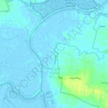
Name: Thurne topographic map, elevation, terrain.
Location: Thurne, Great Yarmouth, Norfolk, England, United Kingdom (52.68002 1.54461 52.70155 1.57357)
Average elevation: 3 m
Minimum elevation: -3 m
Maximum elevation: 17 m
Other topographic maps
Click on a map to view its topography, its elevation and its terrain.
East Somerton
United Kingdom > England > Norfolk > Great Yarmouth > East Somerton
Average elevation: 6 m