
Thank you for supporting this site ❤️
Make a donation
Make a donation
Poplar Creek topographic map
Click on the map to display elevation.
Thank you for supporting this site ❤️
Make a donation
Make a donation
About this map
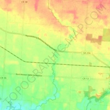
Name: Poplar Creek topographic map, elevation, terrain.
Location: Poplar Creek, Fairfield County, Ohio, 43112, United States (39.82574 -82.68223 39.88871 -82.65061)
Average elevation: 268 m
Minimum elevation: 236 m
Maximum elevation: 296 m
Thank you for supporting this site ❤️
Make a donation
Make a donation
Other topographic maps
Click on a map to view its topography, its elevation and its terrain.
Thank you for supporting this site ❤️
Make a donation
Make a donation
Thank you for supporting this site ❤️
Make a donation
Make a donation
Thank you for supporting this site ❤️
Make a donation
Make a donation
Thank you for supporting this site ❤️
Make a donation
Make a donation