
Наукан topographic map
Interactive map
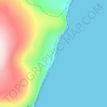
Click on the map to display elevation.
About this map
Name: Наукан topographic map, elevation, terrain.
Average elevation: 150 m
Minimum elevation: -4 m
Maximum elevation: 553 m
Other topographic maps
Click on a map to view its topography, its elevation and its terrain.
Анадырский район
Анадырский район, Tchoukotka, District fédéral extrême-oriental, Russie
Average elevation: 159 m
Île Wrangel
Île Wrangel, городской округ Эгвекинот, Tchoukotka, District fédéral extrême-oriental, Russie
Average elevation: 168 m