
Thank you for supporting this site ❤️
Make a donation
Make a donation
Herselt topographic map
Click on the map to display elevation.
Thank you for supporting this site ❤️
Make a donation
Make a donation
About this map
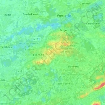
Name: Herselt topographic map, elevation, terrain.
Location: Herselt, Turnhout, Anvers, Flandre, 2230, Belgique (51.01965 4.82825 51.09124 4.96892)
Average elevation: 16 m
Minimum elevation: 3 m
Maximum elevation: 52 m
Thank you for supporting this site ❤️
Make a donation
Make a donation