
Thank you for supporting this site ❤️
Make a donation
Make a donation
Lincoln topographic map
Click on the map to display elevation.
Thank you for supporting this site ❤️
Make a donation
Make a donation
About this map
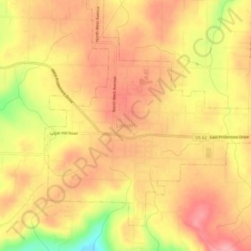
Name: Lincoln topographic map, elevation, terrain.
Location: Lincoln, Washington County, Arkansas, 72744, United States (35.92946 -94.44336 35.96946 -94.40336)
Average elevation: 439 m
Minimum elevation: 364 m
Maximum elevation: 476 m
Thank you for supporting this site ❤️
Make a donation
Make a donation