
Thank you for supporting this site ❤️
Make a donation
Make a donation
Fraser Valley topographic map
Click on the map to display elevation.
Thank you for supporting this site ❤️
Make a donation
Make a donation
About this map
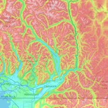
Name: Fraser Valley topographic map, elevation, terrain.
Location: Fraser Valley, British Columbia, Canada (48.87232 -122.57590 50.27232 -121.17590)
Average elevation: 1,025 m
Minimum elevation: -2 m
Maximum elevation: 2,917 m
Thank you for supporting this site ❤️
Make a donation
Make a donation