
Thank you for supporting this site ❤️
Make a donation
Make a donation
Miru topographic map
Click on the map to display elevation.
Thank you for supporting this site ❤️
Make a donation
Make a donation
About this map
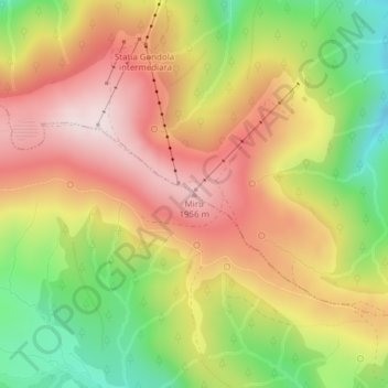
Name: Miru topographic map, elevation, terrain.
Location: Miru, Mălaia, Vâlcea, Roumanie (45.38986 23.70160 45.38996 23.70170)
Average elevation: 1,768 m
Minimum elevation: 1,529 m
Maximum elevation: 1,972 m
Thank you for supporting this site ❤️
Make a donation
Make a donation
Other topographic maps
Click on a map to view its topography, its elevation and its terrain.
Thank you for supporting this site ❤️
Make a donation
Make a donation