
Jatinga topographic map
Click on the map to display elevation.
About this map
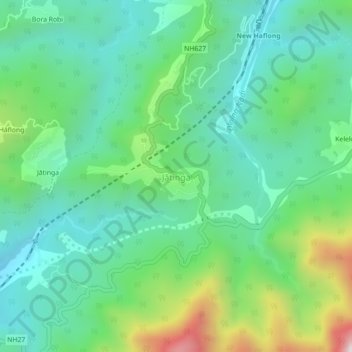
Name: Jatinga topographic map, elevation, terrain.
Location: Jatinga, Haflong, Dima Hasao, Assam, 788819, India (25.11098 93.00173 25.15098 93.04173)
Average elevation: 645 m
Minimum elevation: 386 m
Maximum elevation: 1,339 m
Other topographic maps
Click on a map to view its topography, its elevation and its terrain.