
Thank you for supporting this site ❤️
Make a donation
Make a donation
Matunggong topographic map
Click on the map to display elevation.
Thank you for supporting this site ❤️
Make a donation
Make a donation
About this map
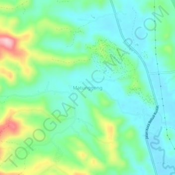
Name: Matunggong topographic map, elevation, terrain.
Location: Matunggong, Kudat, Kudat Division, Sabah, Malaysia (6.69513 116.70254 6.73513 116.74254)
Average elevation: 65 m
Minimum elevation: 5 m
Maximum elevation: 221 m
Thank you for supporting this site ❤️
Make a donation
Make a donation
Other topographic maps
Click on a map to view its topography, its elevation and its terrain.