
Thank you for supporting this site ❤️
Make a donation
Make a donation
Geislingen an der Steige topographic map
Click on the map to display elevation.
Thank you for supporting this site ❤️
Make a donation
Make a donation
Geislingen an der Steige
The importance of the Rorgensteig church for the religious life of the Geislingen community decreased since the elevation of the Geislingen Lady Chapel to a parish church (around 1393) and the construction of the present town church in the years 1424 to 1428. Rorgensteig with its mills had special significance as the first medieval "industrial center" of the town.
Thank you for supporting this site ❤️
Make a donation
Make a donation
About this map
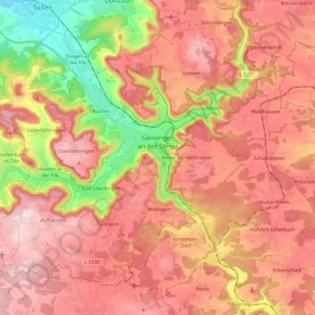
Name: Geislingen an der Steige topographic map, elevation, terrain.
Average elevation: 612 m
Minimum elevation: 352 m
Maximum elevation: 786 m
Thank you for supporting this site ❤️
Make a donation
Make a donation
Other topographic maps
Click on a map to view its topography, its elevation and its terrain.