
Thank you for supporting this site ❤️
Make a donation
Make a donation
Tahtalı topographic map
Click on the map to display elevation.
Thank you for supporting this site ❤️
Make a donation
Make a donation
About this map
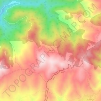
Name: Tahtalı topographic map, elevation, terrain.
Location: Tahtalı, Karamürsel, Kocaeli, Marmara Region, Turkey (40.55692 29.62504 40.59692 29.66504)
Average elevation: 565 m
Minimum elevation: 239 m
Maximum elevation: 778 m
Thank you for supporting this site ❤️
Make a donation
Make a donation