
Thank you for supporting this site ❤️
Make a donation
Make a donation
Ashland topographic map
Click on the map to display elevation.
Thank you for supporting this site ❤️
Make a donation
Make a donation
About this map
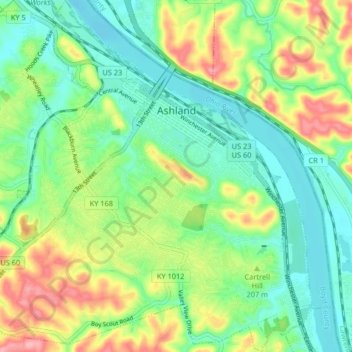
Name: Ashland topographic map, elevation, terrain.
Location: Ashland, Boyd County, Kentucky, United States (38.43440 -82.68193 38.49846 -82.60629)
Average elevation: 196 m
Minimum elevation: 155 m
Maximum elevation: 270 m
Thank you for supporting this site ❤️
Make a donation
Make a donation
Other topographic maps
Click on a map to view its topography, its elevation and its terrain.