
Thank you for supporting this site ❤️
Make a donation
Make a donation
Stover topographic map
Click on the map to display elevation.
Thank you for supporting this site ❤️
Make a donation
Make a donation
About this map
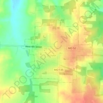
Name: Stover topographic map, elevation, terrain.
Location: Stover, Morgan County, Missouri, United States (38.43366 -93.00207 38.44994 -92.97807)
Average elevation: 322 m
Minimum elevation: 293 m
Maximum elevation: 345 m
Thank you for supporting this site ❤️
Make a donation
Make a donation