

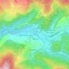
Teyssode topographic map
Click on the map to display elevation.
Teyssode
La superficie de Teyssode est de 2 288 hectares. L'altitude de la commune varie de 127 à 327 mètres.
About this map

Name: Teyssode topographic map, elevation, terrain.
Average elevation: 202 m
Minimum elevation: 130 m
Maximum elevation: 334 m
Other topographic maps
Click on a map to view its topography, its elevation and its terrain.

Forêt domaniale de la Grésigne
France > Occitanie > Tarn > Castelnau-de-Montmiral
Average elevation: 315 m
























Le Drétgenq Hameau
France > Occitanie > Tarn > Puylaurens > Le Drétgenq Hameau
Average elevation: 267 m



Le Moulin à Papier
France > Occitanie > Tarn > Mazamet > Hautpoul > Le Moulin à Papier
Average elevation: 450 m




Le Bout du Pont
France > Occitanie > Tarn > Bout-du-Pont-de-Larn > Le Bout du Pont
Average elevation: 314 m