
Arneiro das Milhariças topographic map
Interactive map
Click on the map to display elevation.
About this map
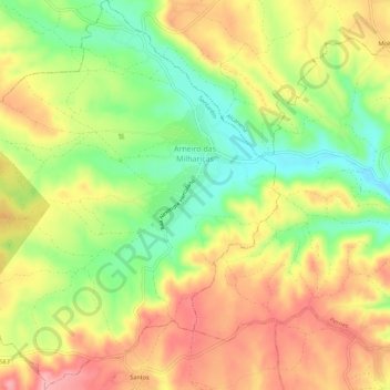
Name: Arneiro das Milhariças topographic map, elevation, terrain.
Location: Arneiro das Milhariças, Santarém, Portugal (39.37343 -8.74665 39.41642 -8.69385)
Average elevation: 103 m
Minimum elevation: 40 m
Maximum elevation: 159 m
Other topographic maps
Click on a map to view its topography, its elevation and its terrain.
Achete, Azoia de Baixo e Póvoa de Santarém
Portugal > Santarém > Santarém
Achete, Azoia de Baixo e Póvoa de Santarém, Santarém, 2000-343, Portugal
Average elevation: 78 m