
Thank you for supporting this site ❤️
Make a donation
Make a donation
Challancin topographic map
Click on the map to display elevation.
Thank you for supporting this site ❤️
Make a donation
Make a donation
About this map
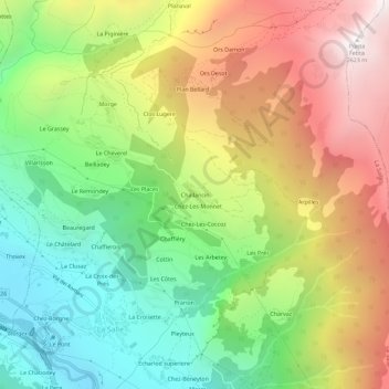
Name: Challancin topographic map, elevation, terrain.
Location: Challancin, La Salle, Valle d'Aosta, 11015, Italia (45.73923 7.06308 45.77923 7.10308)
Average elevation: 1,626 m
Minimum elevation: 861 m
Maximum elevation: 2,609 m
Thank you for supporting this site ❤️
Make a donation
Make a donation