
Thank you for supporting this site ❤️
Make a donation
Make a donation
Carlungie topographic map
Click on the map to display elevation.
Thank you for supporting this site ❤️
Make a donation
Make a donation
About this map
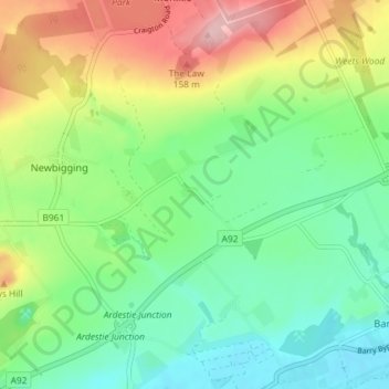
Name: Carlungie topographic map, elevation, terrain.
Location: Carlungie, Angus, Scotland, DD7 7SD, United Kingdom (56.49239 -2.81194 56.53239 -2.77194)
Average elevation: 66 m
Minimum elevation: 4 m
Maximum elevation: 177 m
Thank you for supporting this site ❤️
Make a donation
Make a donation
Other topographic maps
Click on a map to view its topography, its elevation and its terrain.
Thank you for supporting this site ❤️
Make a donation
Make a donation
Thank you for supporting this site ❤️
Make a donation
Make a donation
Thank you for supporting this site ❤️
Make a donation
Make a donation
Thank you for supporting this site ❤️
Make a donation
Make a donation