
Oneida County topographic map
Click on the map to display elevation.
About this map
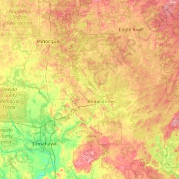
Name: Oneida County topographic map, elevation, terrain.
Location: Oneida County, Wisconsin, United States (45.46444 -90.04531 45.90137 -89.04653)
Average elevation: 489 m
Minimum elevation: 424 m
Maximum elevation: 584 m
Other topographic maps
Click on a map to view its topography, its elevation and its terrain.