
Thank you for supporting this site ❤️
Make a donation
Make a donation
Montalto Ligure topographic map
Click on the map to display elevation.
Thank you for supporting this site ❤️
Make a donation
Make a donation
About this map
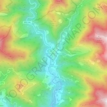
Name: Montalto Ligure topographic map, elevation, terrain.
Average elevation: 529 m
Minimum elevation: 158 m
Maximum elevation: 1,069 m
Thank you for supporting this site ❤️
Make a donation
Make a donation
Other topographic maps
Click on a map to view its topography, its elevation and its terrain.
Thank you for supporting this site ❤️
Make a donation
Make a donation
Bajardo
Italy > Liguria > Provincia di Imperia
Its principal settlement, Bajardo itself, is a medieval village which stands at an elevation of 900 metres (3,000 ft) on a peak at the head of the basin of the Nervia torrent.
Average elevation: 710 m
Thank you for supporting this site ❤️
Make a donation
Make a donation