
Thank you for supporting this site ❤️
Make a donation
Make a donation
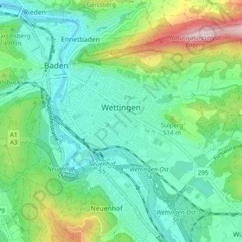
Wettingen topographic map
Click on the map to display elevation.
Thank you for supporting this site ❤️
Make a donation
Make a donation
Wettingen
Wettingen has an area, as of 2006, of 10.6 square kilometers (4.1 sq mi). Of this area, 21.6% is used for agricultural purposes, while 39.1% is forested. Of the rest of the land, 37.6% is settled (buildings or roads) and the remainder (1.8%) is non-productive (rivers or lakes). The highest elevation is 859 m (2,818 ft) at the Burghorn, a part of the Lägern, and the lowest elevation is 360 m (1,180 ft) at the Limmat.
Thank you for supporting this site ❤️
Make a donation
Make a donation
About this map
Name: Wettingen topographic map, elevation, terrain.
Location: Wettingen, Bezirk Baden, Aargau, Switzerland (47.44493 8.30851 47.48147 8.37531)
Average elevation: 461 m
Minimum elevation: 345 m
Maximum elevation: 786 m
Thank you for supporting this site ❤️
Make a donation
Make a donation