
Lloroñi topographic map
Interactive map
Click on the map to display elevation.
About this map
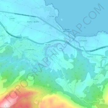
Name: Lloroñi topographic map, elevation, terrain.
Location: Lloroñi, Colunga, Asturien, 33342, Spanien (43.44773 -5.24598 43.48773 -5.20598)
Average elevation: 107 m
Minimum elevation: 0 m
Maximum elevation: 678 m