
Thank you for supporting this site ❤️
Make a donation
Make a donation
Ortona topographic map
Click on the map to display elevation.
Thank you for supporting this site ❤️
Make a donation
Make a donation
About this map
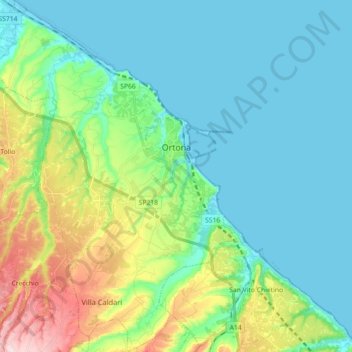
Name: Ortona topographic map, elevation, terrain.
Location: Ortona, Chieti, Italy (42.27244 14.31265 42.40479 14.43995)
Average elevation: 65 m
Minimum elevation: -2 m
Maximum elevation: 274 m
Thank you for supporting this site ❤️
Make a donation
Make a donation
Other topographic maps
Click on a map to view its topography, its elevation and its terrain.
Thank you for supporting this site ❤️
Make a donation
Make a donation
Thank you for supporting this site ❤️
Make a donation
Make a donation