
Spatenberge - Rote Berge topographic map
Interactive map
Click on the map to display elevation.
About this map
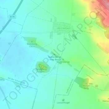
Name: Spatenberge - Rote Berge topographic map, elevation, terrain.
Average elevation: 167 m
Minimum elevation: 140 m
Maximum elevation: 253 m
Other topographic maps
Click on a map to view its topography, its elevation and its terrain.
Heldrungen
Deutschland > Thüringen > Kyffhäuserkreis > An der Schmücke > Heldrungen
Heldrungen, An der Schmücke, Kyffhäuserkreis, Thüringen, 06577, Deutschland
Average elevation: 160 m