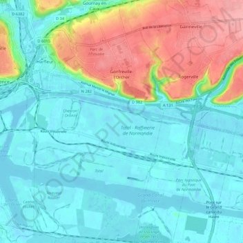
Gonfreville-l'Orcher topographic map
Interactive map
Click on the map to display elevation.
About this map
Name: Gonfreville-l'Orcher topographic map, elevation, terrain.
Average elevation: 29 m
Minimum elevation: -6 m
Maximum elevation: 111 m

Click on the map to display elevation.
Name: Gonfreville-l'Orcher topographic map, elevation, terrain.
Average elevation: 29 m
Minimum elevation: -6 m
Maximum elevation: 111 m