
"Lanterna" topographic map
Interactive map
Click on the map to display elevation.
About this map
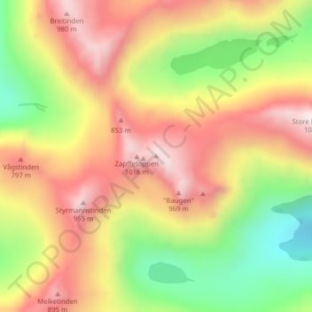
Name: "Lanterna" topographic map, elevation, terrain.
Location: "Lanterna", Tromsø, Troms og Finnmark, Noorwegen (69.73133 18.55154 69.73143 18.55164)
Average elevation: 566 m
Minimum elevation: 126 m
Maximum elevation: 994 m
Other topographic maps
Click on a map to view its topography, its elevation and its terrain.
Sommarøy
Noorwegen > Troms og Finnmark > Tromsø
Sommarøy, Tromsø, Troms og Finnmark, 9110, Noorwegen
Average elevation: 6 m