
Thank you for supporting this site ❤️
Make a donation
Make a donation
Anlier topographic map
Click on the map to display elevation.
Thank you for supporting this site ❤️
Make a donation
Make a donation
About this map
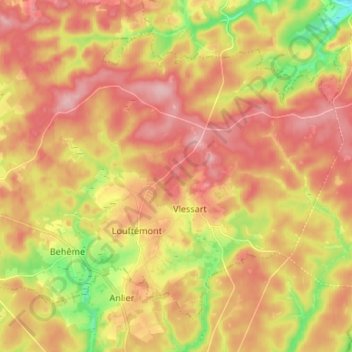
Name: Anlier topographic map, elevation, terrain.
Location: Anlier, Léglise, Neufchâteau, Luxembourg, Wallonie, Belgique (49.76752 5.57236 49.83732 5.70534)
Average elevation: 459 m
Minimum elevation: 371 m
Maximum elevation: 521 m
Thank you for supporting this site ❤️
Make a donation
Make a donation