
Thank you for supporting this site ❤️
Make a donation
Make a donation
Solsberry topographic map
Click on the map to display elevation.
Thank you for supporting this site ❤️
Make a donation
Make a donation
About this map
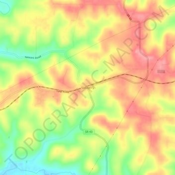
Name: Solsberry topographic map, elevation, terrain.
Location: Solsberry, Greene County, Indiana, 47459, United States (39.06338 -86.77611 39.10338 -86.73611)
Average elevation: 223 m
Minimum elevation: 166 m
Maximum elevation: 264 m
Thank you for supporting this site ❤️
Make a donation
Make a donation
Other topographic maps
Click on a map to view its topography, its elevation and its terrain.