
Zama topographic map
Click on the map to display elevation.
About this map
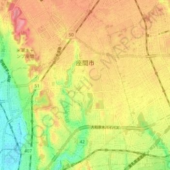
Name: Zama topographic map, elevation, terrain.
Location: Zama, Kanagawa Prefecture, Japan (35.46844 139.37371 35.51543 139.43883)
Average elevation: 72 m
Minimum elevation: 22 m
Maximum elevation: 112 m
Other topographic maps
Click on a map to view its topography, its elevation and its terrain.