
Thank you for supporting this site ❤️
Make a donation
Make a donation
Longone Sabino topographic map
Click on the map to display elevation.
Thank you for supporting this site ❤️
Make a donation
Make a donation
About this map
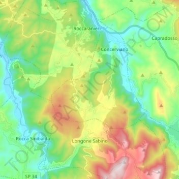
Name: Longone Sabino topographic map, elevation, terrain.
Location: Longone Sabino, Rieti, Lazio, Italy (42.25242 12.90351 42.34966 12.99407)
Average elevation: 712 m
Minimum elevation: 407 m
Maximum elevation: 1,317 m
Thank you for supporting this site ❤️
Make a donation
Make a donation
Other topographic maps
Click on a map to view its topography, its elevation and its terrain.