
City District of Calbayog (Oquendo) topographic map
Interactive map
Click on the map to display elevation.
About this map
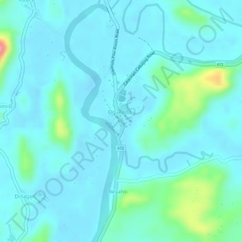
Name: City District of Calbayog (Oquendo) topographic map, elevation, terrain.
Average elevation: 17 m
Minimum elevation: -3 m
Maximum elevation: 98 m
Other topographic maps
Click on a map to view its topography, its elevation and its terrain.
Carayman
Philippines > Samar > Calbayog
Carayman, Calbayog, Samar, Eastern Visayas, 6710, Philippines
Average elevation: 9 m
Aguit-itan
Philippines > Samar > Calbayog
Aguit-itan, Calbayog, Samar, Eastern Visayas, 6710, Philippines
Average elevation: 5 m
Calbayog City Drainage Line
Philippines > Samar > Calbayog
Calbayog City Drainage Line, Calbayog, Samar, Eastern Visayas, 6710, Philippines
Average elevation: 3 m
Caballero
Philippines > Samar > Calbayog > Caballero
Caballero, Calbayog, Samar, Eastern Visayas, 6710, Philippines
Average elevation: 12 m