
Thank you for supporting this site ❤️
Make a donation
Make a donation
Felgar topographic map
Click on the map to display elevation.
Thank you for supporting this site ❤️
Make a donation
Make a donation
About this map
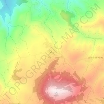
Name: Felgar topographic map, elevation, terrain.
Location: Felgar, Torre de Moncorvo, Bragance, 5160-085, Portugal (41.19009 -6.97790 41.23009 -6.93790)
Average elevation: 552 m
Minimum elevation: 173 m
Maximum elevation: 885 m
Thank you for supporting this site ❤️
Make a donation
Make a donation
Other topographic maps
Click on a map to view its topography, its elevation and its terrain.