
Lemon Township topographic map
Click on the map to display elevation.
About this map
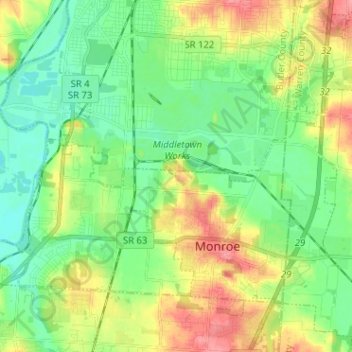
Name: Lemon Township topographic map, elevation, terrain.
Location: Lemon Township, Butler County, Ohio, United States (39.42753 -84.46425 39.49839 -84.34261)
Average elevation: 208 m
Minimum elevation: 180 m
Maximum elevation: 298 m
Other topographic maps
Click on a map to view its topography, its elevation and its terrain.