
Thank you for supporting this site ❤️
Make a donation
Make a donation
Abermorddu topographic map
Click on the map to display elevation.
Thank you for supporting this site ❤️
Make a donation
Make a donation
About this map
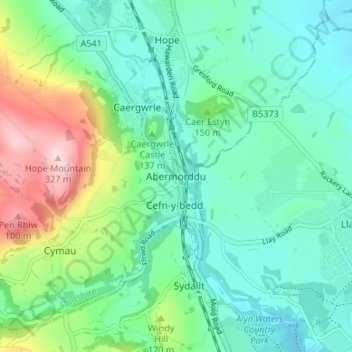
Name: Abermorddu topographic map, elevation, terrain.
Location: Abermorddu, Flintshire, Wales, LL12 9DD, United Kingdom (53.08250 -3.05248 53.12250 -3.01248)
Average elevation: 124 m
Minimum elevation: 54 m
Maximum elevation: 323 m
Thank you for supporting this site ❤️
Make a donation
Make a donation
Other topographic maps
Click on a map to view its topography, its elevation and its terrain.