
Thank you for supporting this site ❤️
Make a donation
Make a donation
Moongilpatti topographic map
Click on the map to display elevation.
Thank you for supporting this site ❤️
Make a donation
Make a donation
About this map
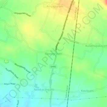
Name: Moongilpatti topographic map, elevation, terrain.
Location: Moongilpatti, Mohanur, Namakkal District, Tamil Nadu, India (11.10410 78.13242 11.14410 78.17242)
Average elevation: 157 m
Minimum elevation: 134 m
Maximum elevation: 191 m
Thank you for supporting this site ❤️
Make a donation
Make a donation