
Lamentin topographic map
Interactive map
Click on the map to display elevation.
About this map
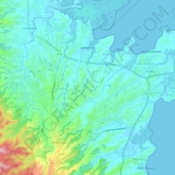
Name: Lamentin topographic map, elevation, terrain.
Location: Lamentin, Basse-Terre, Guadeloupe, 97129, France (16.18917 -61.73351 16.29937 -61.61393)
Average elevation: 40 m
Minimum elevation: -1 m
Maximum elevation: 257 m