
Thank you for supporting this site ❤️
Make a donation
Make a donation
Eagle topographic map
Click on the map to display elevation.
Thank you for supporting this site ❤️
Make a donation
Make a donation
About this map
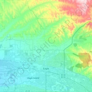
Name: Eagle topographic map, elevation, terrain.
Location: Eagle, Ada County, Idaho, 83616, United States (43.66282 -116.46336 43.78971 -116.30647)
Average elevation: 851 m
Minimum elevation: 760 m
Maximum elevation: 1,150 m
Thank you for supporting this site ❤️
Make a donation
Make a donation