
Thank you for supporting this site ❤️
Make a donation
Make a donation
Sterling topographic map
Click on the map to display elevation.
Thank you for supporting this site ❤️
Make a donation
Make a donation
About this map
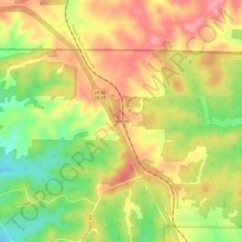
Name: Sterling topographic map, elevation, terrain.
Location: Sterling, Howell County, Missouri, United States (37.02394 -92.02821 37.06394 -91.98821)
Average elevation: 435 m
Minimum elevation: 372 m
Maximum elevation: 484 m
Thank you for supporting this site ❤️
Make a donation
Make a donation
Other topographic maps
Click on a map to view its topography, its elevation and its terrain.