
Thank you for supporting this site ❤️
Make a donation
Make a donation
Thunder Hawk topographic map
Click on the map to display elevation.
Thank you for supporting this site ❤️
Make a donation
Make a donation
About this map
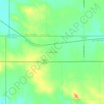
Name: Thunder Hawk topographic map, elevation, terrain.
Location: Thunder Hawk, Corson County, South Dakota, United States (45.91833 -101.99487 45.95833 -101.95487)
Average elevation: 791 m
Minimum elevation: 772 m
Maximum elevation: 819 m
Thank you for supporting this site ❤️
Make a donation
Make a donation
Other topographic maps
Click on a map to view its topography, its elevation and its terrain.