
Thank you for supporting this site ❤️
Make a donation
Make a donation
Ráquira topographic map
Click on the map to display elevation.
Thank you for supporting this site ❤️
Make a donation
Make a donation
About this map
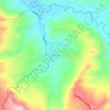
Name: Ráquira topographic map, elevation, terrain.
Location: Ráquira, Ricaurte, Boyacá, RAP (Especial) Central, Colombia (5.51801 -73.65222 5.55801 -73.61222)
Average elevation: 2,253 m
Minimum elevation: 2,110 m
Maximum elevation: 2,509 m
Thank you for supporting this site ❤️
Make a donation
Make a donation
Other topographic maps
Click on a map to view its topography, its elevation and its terrain.