
Thank you for supporting this site ❤️
Make a donation
Make a donation
Sibculo topographic map
Click on the map to display elevation.
Thank you for supporting this site ❤️
Make a donation
Make a donation
About this map
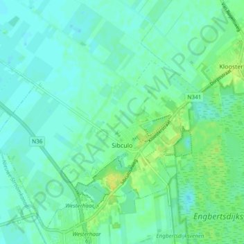
Name: Sibculo topographic map, elevation, terrain.
Location: Sibculo, Hardenberg, Oberyssel, Niederlande (52.46560 6.58850 52.50540 6.66312)
Average elevation: 12 m
Minimum elevation: 6 m
Maximum elevation: 24 m
Thank you for supporting this site ❤️
Make a donation
Make a donation
Other topographic maps
Click on a map to view its topography, its elevation and its terrain.