
(Dolní Věstonice) topographic map
Interactive map
Click on the map to display elevation.
About this map
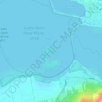
Name: (Dolní Věstonice) topographic map, elevation, terrain.
Average elevation: 169 m
Minimum elevation: 163 m
Maximum elevation: 270 m
Other topographic maps
Click on a map to view its topography, its elevation and its terrain.
Unter Wisternitz
Tschechien > Südosten > Südmährische Region > Unter Wisternitz
Unter Wisternitz, Bezirk Lundenburg, Südmährische Region, Südosten, 691 29, Tschechien
Average elevation: 189 m