
Thank you for supporting this site ❤️
Make a donation
Make a donation
Mandeh topographic map
Click on the map to display elevation.
Thank you for supporting this site ❤️
Make a donation
Make a donation
About this map
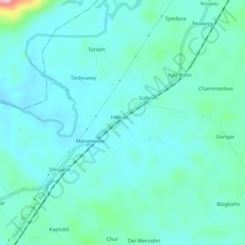
Name: Mandeh topographic map, elevation, terrain.
Location: Mandeh, Neekreen, Grand Bassa County, Liberia (6.01391 -9.89290 6.05391 -9.85290)
Average elevation: 68 m
Minimum elevation: 40 m
Maximum elevation: 220 m
Thank you for supporting this site ❤️
Make a donation
Make a donation