

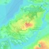
Cap Saint-Jacques topographic map
Click on the map to display elevation.
About this map

Name: Cap Saint-Jacques topographic map, elevation, terrain.
Average elevation: 25 m
Minimum elevation: 18 m
Maximum elevation: 35 m
Other topographic maps
Click on a map to view its topography, its elevation and its terrain.

Pierrefonds-Roxboro
Canada > Quebec > Urban agglomeration of Montreal > Montreal
Average elevation: 30 m

Rivière des Prairies
Canada > Quebec > Urban agglomeration of Montreal > Montreal
Average elevation: 36 m


Rivière des Prairies
Canada > Quebec > Urban agglomeration of Montreal > Montreal
Average elevation: 34 m

Parc de la Rive-Boisée
Canada > Quebec > Urban agglomeration of Montreal > Montreal
Average elevation: 29 m


Notre Dame Island
Canada > Quebec > Urban agglomeration of Montreal > Montreal
Average elevation: 14 m

Rosemont–La Petite-Patrie
Canada > Quebec > Urban agglomeration of Montreal > Montreal
Average elevation: 50 m


Parc Léon-Provancher
Canada > Quebec > Urban agglomeration of Montreal > Montreal
Average elevation: 53 m

Saint Helen's Island
Canada > Quebec > Urban agglomeration of Montreal > Montreal
Average elevation: 15 m

Le Plateau-Mont-Royal
Canada > Quebec > Urban agglomeration of Montreal > Montreal
Average elevation: 70 m

Parc-nature du Bois-de-Liesse
Canada > Quebec > Urban agglomeration of Montreal > Montreal
Average elevation: 28 m


Parc-nature de la Pointe-aux-Prairies
Canada > Quebec > Urban agglomeration of Montreal > Montreal
Average elevation: 12 m

Mount Royal Park
Canada > Quebec > Urban agglomeration of Montreal > Montreal
The mountain is part of the Monteregian Hills , situated between the Laurentians and the Appalachian Mountains. It gave its Latin name, Mons Regius, to the Monteregian chain. The mountain consists of three peaks: Colline de la Croix (or Mont Royal proper) at 233 m (764 ft), Colline d'Outremont (or Mount…
Average elevation: 112 m


