Geolocate

Jayawijaya topographic map

Interactive map

Click on the map to display elevation.

About this map

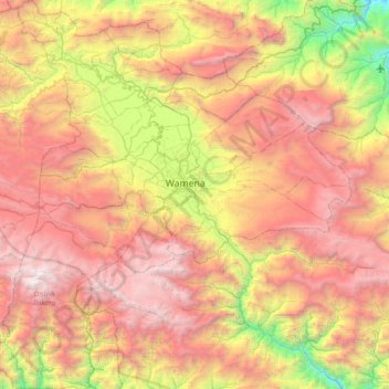
Name: Jayawijaya topographic map, elevation, terrain.

Location: Jayawijaya, Highland Papua, Western New Guinea, Indonesia (-4.47843 138.58310 -3.75421 139.25725)

Average elevation: 2,469 m

Minimum elevation: 489 m

Maximum elevation: 4,531 m

Other topographic maps

Click on a map to view its topography, its elevation and its terrain.

Tolikara

Indonesia > Highland Papua

Tolikara, Highland Papua, Western New Guinea, Indonesia

Average elevation: 1,286 m

Yahukimo

Indonesia > Highland Papua

Yahukimo, Highland Papua, Western New Guinea, Indonesia

Average elevation: 1,320 m

Pegunungan Bintang

Indonesia > Highland Papua

Pegunungan Bintang, Highland Papua, Western New Guinea, Indonesia

Average elevation: 999 m