
Ottawa topographic map
Click on the map to display elevation.
About this map
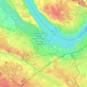
Name: Ottawa topographic map, elevation, terrain.
Location: Kanata, Ottawa, Eastern Ontario, Ontario, Canada (45.26737 -76.06016 45.46177 -75.83532)
Average elevation: 93 m
Minimum elevation: 50 m
Maximum elevation: 171 m
Other topographic maps
Click on a map to view its topography, its elevation and its terrain.