
Amirli topographic map
Interactive map
Click on the map to display elevation.
About this map
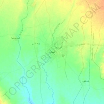
Name: Amirli topographic map, elevation, terrain.
Average elevation: 174 m
Minimum elevation: 159 m
Maximum elevation: 193 m
Other topographic maps
Click on a map to view its topography, its elevation and its terrain.
Lake Tharthar
Lake Tharthar, Saladin Governorate, Iraq
Average elevation: 85 m
Baiji
Iraq > Saladin Governorate > Baiji
Baiji, Baiji Central Subdistrict, Baiji District, Saladin Governorate, Iraq
Average elevation: 154 m
Samarra
Samarra, Samarra Central Subdistrict, Samarra District, Saladin Governorate, 34010, Iraq
Average elevation: 70 m
Baiji
Baiji, Baiji Central Subdistrict, Baiji District, Saladin Governorate, Iraq
Average elevation: 115 m