
Sendim topographic map
Interactive map
Click on the map to display elevation.
About this map
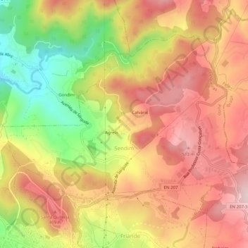
Name: Sendim topographic map, elevation, terrain.
Location: Sendim, Felgueiras, Porto, Portugal (41.37336 -8.20461 41.40047 -8.15471)
Average elevation: 380 m
Minimum elevation: 177 m
Maximum elevation: 523 m
Other topographic maps
Click on a map to view its topography, its elevation and its terrain.