
Thank you for supporting this site ❤️
Make a donation
Make a donation
Les Vitarelles topographic map
Click on the map to display elevation.
Thank you for supporting this site ❤️
Make a donation
Make a donation
About this map
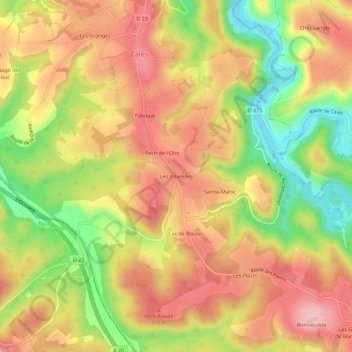
Name: Les Vitarelles topographic map, elevation, terrain.
Average elevation: 211 m
Minimum elevation: 101 m
Maximum elevation: 295 m
Thank you for supporting this site ❤️
Make a donation
Make a donation
Other topographic maps
Click on a map to view its topography, its elevation and its terrain.
L'Ouysse
France > Occitanie > Lot > Calès
L'Ouysse prend sa source dans le nord du département du Lot, en limite des communes d'Anglars et Lacapelle-Marival vers 390 mètres d'altitude. La longueur officielle du cours d'eau est de 41,12 km, mais cette longueur est certainement sous-évaluée.
Average elevation: 271 m