長徑村 Cheung Kang Village topographic map
Interactive map
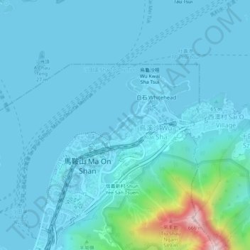
Click on the map to display elevation.
About this map
Name: 長徑村 Cheung Kang Village topographic map, elevation, terrain.
Average elevation: 62 m
Minimum elevation: -7 m
Maximum elevation: 655 m

Click on the map to display elevation.
Name: 長徑村 Cheung Kang Village topographic map, elevation, terrain.
Average elevation: 62 m
Minimum elevation: -7 m
Maximum elevation: 655 m