
Wilchingen topographic map
Interactive map
Click on the map to display elevation.
About this map
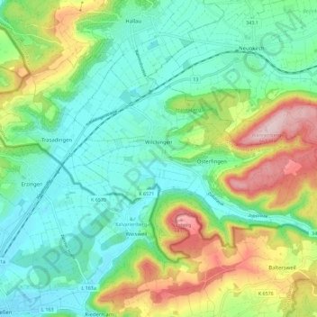
Name: Wilchingen topographic map, elevation, terrain.
Location: Wilchingen, Bezirk Unterklettgau, Schaffhouse, Suisse (47.63842 8.42142 47.68833 8.53466)
Average elevation: 476 m
Minimum elevation: 389 m
Maximum elevation: 670 m